28
2026
Adding Real World Location to Ice Fishing Prototype
 An article by

Workflow
– Elevation model, Orthophoto and laser scan data from Maanmittauslaitos (CC4)
– Import geotiff to Unity https://github.com/unitycoder/UnityGeoTiffImporter
– Import .jp2 to Unity https://github.com/unitycoder/JP2Converter
– Create terrain from geotiff elevation map (unity editor tool)
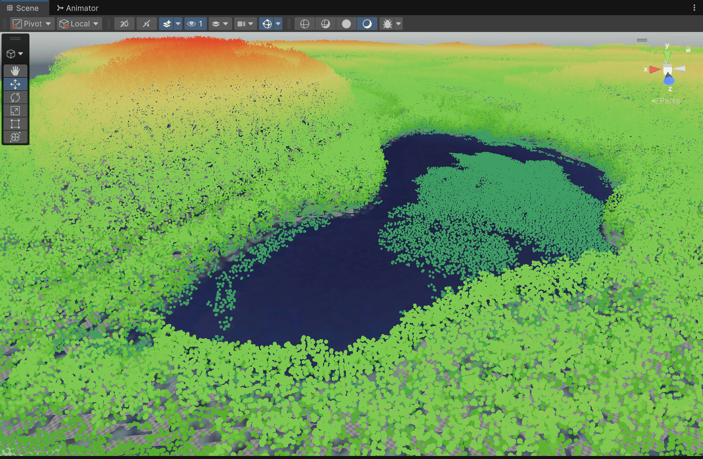
– Compare with laser scan data for real world size https://las2gltf.kelobyte.fi/
– Crop terrain and orthophoto for the game area (unity editor tool)
– Create lake depth map for the lake, if not available online (photoshop)
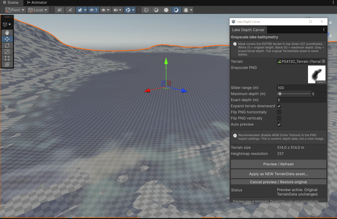
– Use lake depth map to lower terrain in lake area (unity editor tool)
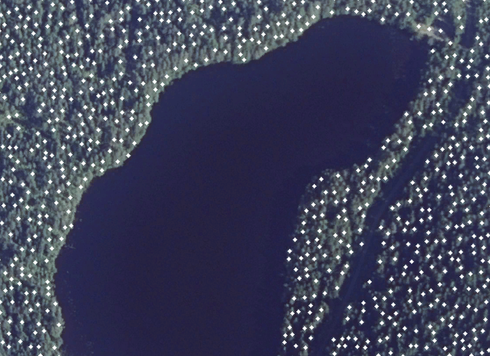
– Get tree positions from orthophoto into CSV (python script)
– Plant trees to terrain (unity editor tool)
Images
Python Tree Detection Image Processing
Editor tool to preview and apply heightmap for lake
Laser scan overlayed to terrain, validate real world sizes
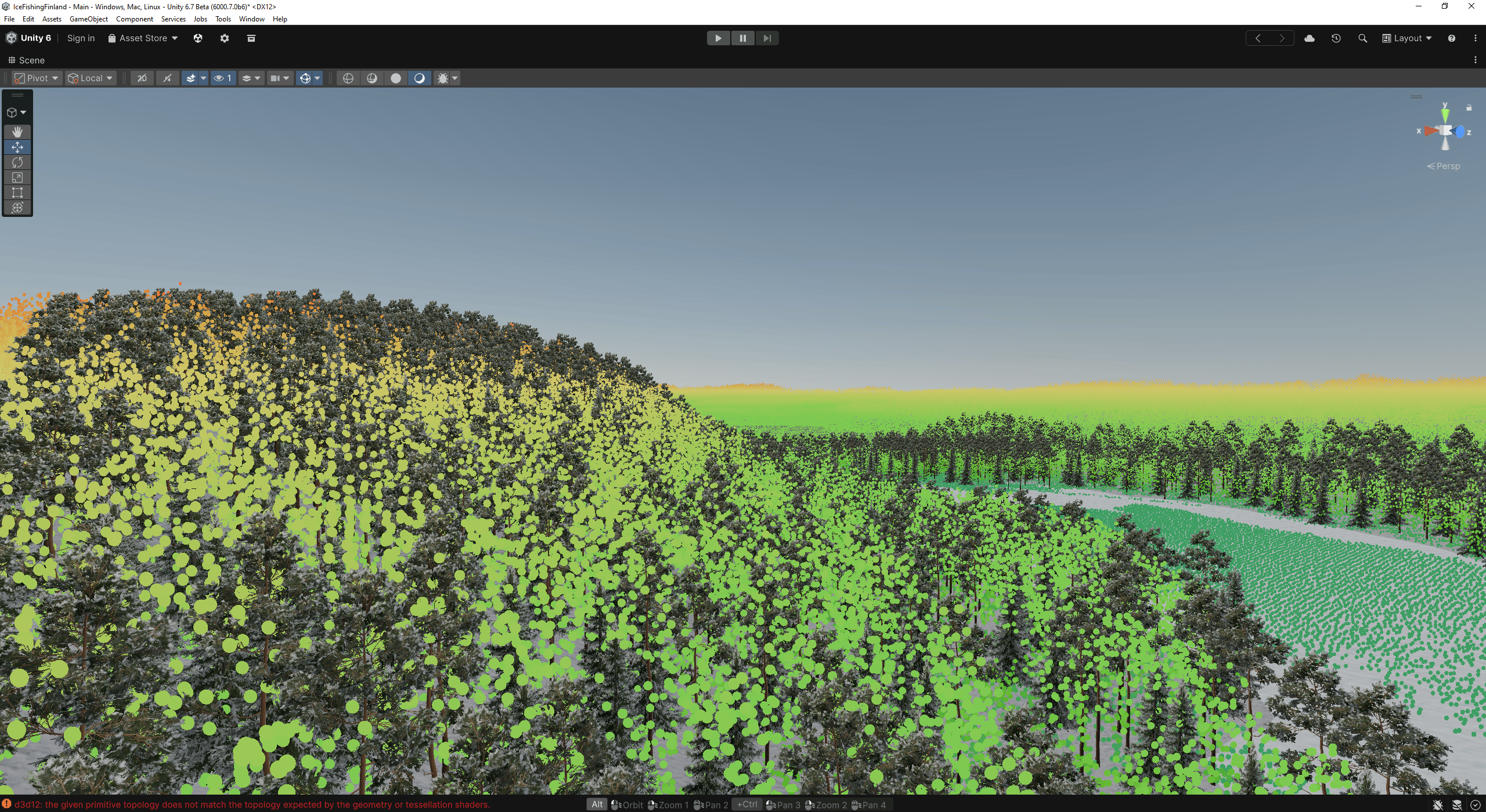
Compare tree heights also
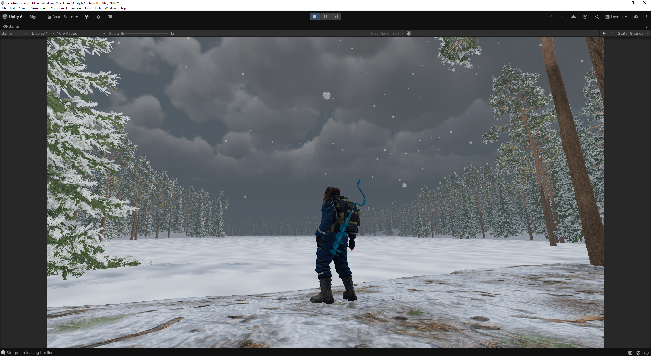
Game view
Planting trees with Editor tool (at detected tree positions)
test play


Related Posts


Leave a comment
Recent posts
- Adding Real World Location to Ice Fishing Prototype
- [web tool] Image Channel Inspector : AlphaScope
- Editor Tool: Smart Recompile (don’t recompile if edit comments)
- Editor Tool: Scene Size Analyzer
- LudumDare 60: Old Tech
- uBasic Scripting Language for Unity
- GreaseMonkey+Editor Plugin: 1-Click Copy script from ChatGPT (Web) to Unity Editor (as script)
- Editor Tool: Property Watcher
- .unityignore : Hide files from Project window
- PostBuild Script to Create Single exe Standalone File
- Game Loop Designer
- Favorites in PackageManager
Connect


Recent Comments
Coin:
CUgDSbRqFcAumDSAcdKDvuXsw26VdkJe8C8WGUQHBAGS